
Watch short for this article (5 slides)
From Rainbow Hues to Roaring Storms: Unpacking Fascinating Meteorological Phenomena
The sky above is a theater of constant atmospheric drama. From the gentle beauty of a rainbow arching across a rain-washed landscape to the terrifying power of a spinning tornado, meteorological phenomena evoke a range of human emotions, from awe and wonder to profound fear. While ancient cultures often attributed these events to the whims of gods or spirits, modern science allows us to understand the intricate physical processes driving them. Let's explore the science behind some of the most captivating weather events that shape our world and capture our imagination.
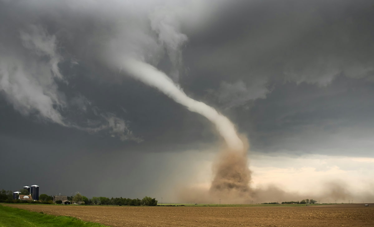
Photo by Greg Johnson on Unsplash - Severe weather like tornadoes showcases nature's immense power.
The Rainbow: An Optical Masterpiece
Perhaps the most universally beloved atmospheric phenomenon, the rainbow is an optical illusion created by the interaction of sunlight with water droplets (typically rain, but also mist or fog).
- The Physics of Color: Rainbows form through a combination of refraction, internal reflection, and dispersion.
- Sunlight enters a water droplet and refracts (bends) slightly.
- As it travels through the droplet, the light disperses, separating into its component colors (wavelengths) because different colors bend at slightly different angles (violet light bends most, red light least).
- The dispersed light then reflects off the inner back surface of the droplet (internal reflection).
- Finally, the light refracts again as it exits the droplet, further separating the colors.
- Specific Geometry: To see a rainbow, the Sun must be behind you, and rain or mist must be in front of you. The center of the rainbow's arc is always directly opposite the Sun in the sky (the anti-solar point). The primary rainbow forms an arc with an angular radius of approximately 42 degrees, with red on the outer edge and violet on the inner edge.
- Double Rainbows: Sometimes, a fainter secondary rainbow is visible outside the primary bow, with colors reversed (red on the inside, violet on the outside). This is formed by sunlight undergoing two internal reflections within the raindrops. The region between the two bows often appears darker and is known as Alexander's band. (Source: NASA SciJinks - Rainbows)
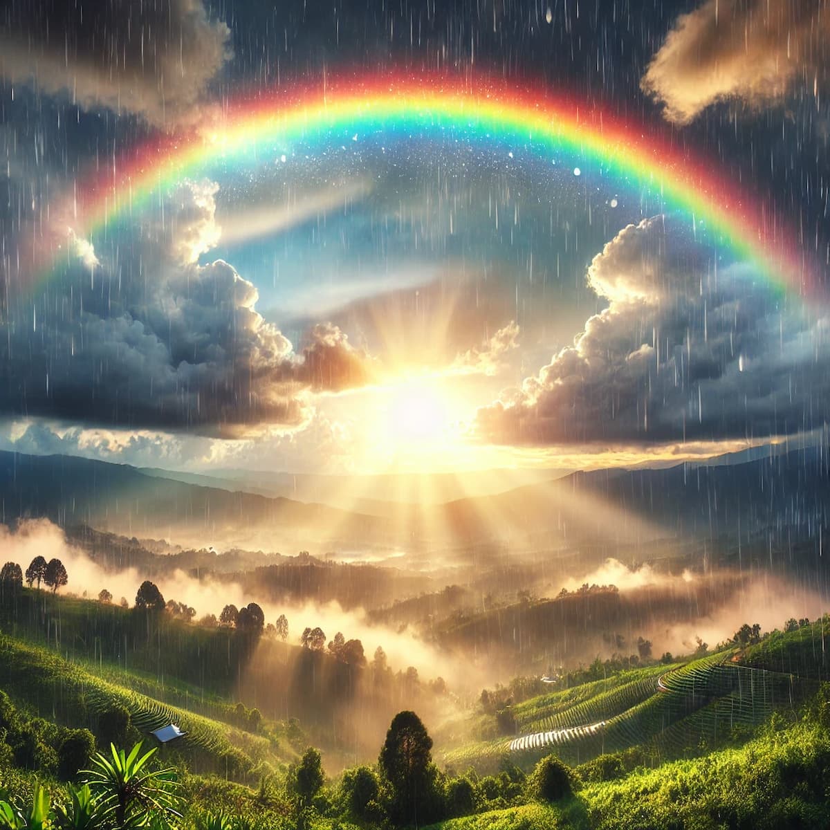
Double rainbows result from two internal reflections of sunlight within raindrops.
The Thunderstorm: An Engine of Instability
Thunderstorms are localized storms produced by cumulonimbus clouds, always accompanied by lightning and thunder. They are born from atmospheric instability.
- Formation Ingredients: Three key ingredients are needed:
- Moisture: Abundant water vapor in the lower atmosphere.
- Instability: A steep vertical temperature gradient, meaning air cools rapidly with height. Warm, moist air near the surface is less dense than the cooler air above, making it buoyant and prone to rising rapidly if given a push.
- Lifting Mechanism: A trigger to force the unstable air upward initially. This can be surface heating (convection), weather fronts (forcing air aloft), mountains (orographic lift), or converging winds.
- Lightning and Thunder: Within the turbulent storm cloud, collisions between ice crystals, graupel (soft hail), and supercooled water droplets transfer electrical charge, leading to charge separation – typically positive charge accumulates near the top of the cloud and negative charge near the base. When the electrical potential difference becomes large enough to overcome the air's insulating properties, a massive electrical discharge occurs – lightning. This discharge can happen within the cloud (IC - intracloud), between clouds (CC - cloud-to-cloud), or between the cloud and the ground (CG - cloud-to-ground). The intense heat of the lightning channel (reaching temperatures hotter than the surface of the Sun, up to 30,000°C or 54,000°F) causes the surrounding air to expand explosively at supersonic speeds, creating a shockwave that we hear as thunder. (Source: NWS Lightning Safety)
- Associated Hazards: Besides lightning, thunderstorms can produce heavy rain (leading to flash floods), hail, strong straight-line winds (downbursts), and, under specific conditions, tornadoes.
The Tornado: Nature's Most Violent Vortex
Tornadoes are violently rotating columns of air extending from the base of a thunderstorm (usually a supercell) to the ground. They are among the most destructive weather phenomena relative to their size.
- Supercell Connection: While tornadoes can form in other storm types, the strongest and longest-lived tornadoes are almost always associated with supercell thunderstorms. Supercells possess a deep, persistently rotating updraft called a mesocyclone, typically several kilometers across.
- Formation Factors: Key ingredients include the instability and moisture needed for severe thunderstorms, plus strong vertical wind shear – significant changes in wind speed and/or direction with height. Wind shear helps initiate the horizontal rotation within the storm environment, which can then be tilted vertically and stretched by the storm's powerful updraft, concentrating the rotation and potentially leading to mesocyclone formation and tornadogenesis.
- The Funnel Cloud vs. Tornado: A funnel cloud is a rotating condensation funnel extending from the cloud base but *not* reaching the ground. It becomes a tornado only when the circulation makes contact with the surface, often indicated by a swirling debris cloud even if the condensation funnel itself doesn't reach all the way down.
- Intensity Measurement (Enhanced Fujita Scale): Tornado intensity is rated after the event, based on observed damage, using the Enhanced Fujita (EF) Scale. Ratings range from EF0 (light damage, winds 65-85 mph) to EF5 (incredible damage, winds over 200 mph). The scale estimates wind speeds based on damage indicators applied to various structures and vegetation. (Source: NWS - Enhanced Fujita Scale)
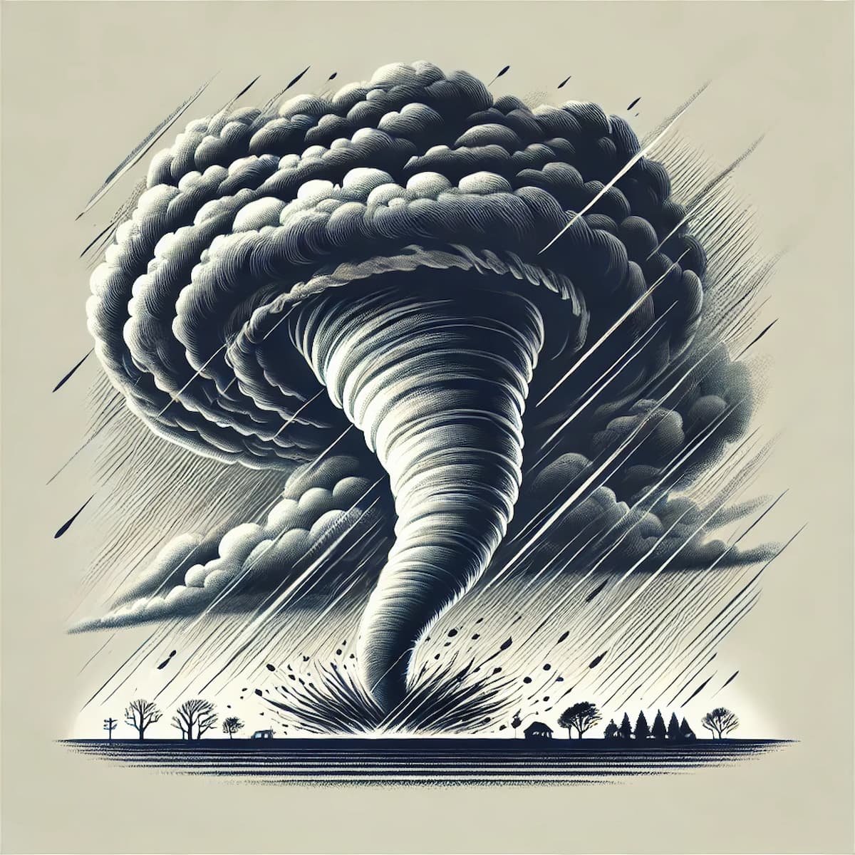
Tornadoes are rated by the damage they cause using the Enhanced Fujita (EF) Scale.
The Aurora (Borealis & Australis): Dancing Polar Lights
Auroras are natural light displays predominantly seen in high-latitude (Arctic and Antarctic) regions, caused by the interaction between charged particles from the Sun and Earth's atmosphere.
- Solar Origin: The Sun continuously emits the solar wind, a stream of charged particles (electrons, protons). During more active solar periods (solar flares, CMEs), this wind becomes denser and faster.
- Magnetospheric Interaction: Earth's magnetic field (magnetosphere) deflects most solar wind but captures some particles, guiding them along magnetic field lines towards the geomagnetic poles.
- Atmospheric Excitation: As these energetic particles collide with gases (primarily atomic oxygen and molecular nitrogen) in the upper atmosphere (typically 80-600 km / 50-400 miles altitude), they transfer energy, exciting the gas atoms/molecules.
- Light Emission: The excited atoms/molecules release this excess energy by emitting photons of light. The color depends on the gas type and altitude: oxygen typically emits green (lower altitudes, ~100-300 km) or red (higher altitudes, >300 km), while nitrogen contributes blues and purples/violets (often at lower edges, <100 km) and some reds. The interplay of these emissions creates the dynamic, colorful auroral displays. (Source: NOAA SWPC - Aurora)
Hurricanes (Typhoons, Cyclones): Ocean-Fueled Rotating Giants
Tropical cyclones (known as hurricanes in the Atlantic/Northeast Pacific, typhoons in the Northwest Pacific, and cyclones in the South Pacific/Indian Ocean) are massive, rotating storm systems that form over warm tropical or subtropical waters.
- Formation Conditions: Several conditions must align:
- Warm sea surface temperatures (generally at least 26.5°C / 80°F through a depth of ~50 meters).
- Sufficient atmospheric moisture.
- A pre-existing weather disturbance (like a tropical wave).
- Low vertical wind shear (little change in wind speed/direction with height, allowing the storm's vertical structure to remain organized).
- Sufficient distance from the equator (typically >5° latitude) for the Coriolis effect (related to Earth's rotation) to initiate and maintain the storm's spin.
- Energy Source: Hurricanes are fueled by the latent heat released when warm, moist air rising from the ocean surface condenses into clouds and rain within the storm. This heat release warms the storm's core, lowers surface pressure, and drives stronger winds, creating a positive feedback loop as long as the storm remains over warm water.
- Structure: Mature hurricanes develop a distinct structure: a calm central eye (sinking air), surrounded by the intense eyewall (strongest winds, heaviest rain, rising air), and outer spiral rainbands.
- Intensity Measurement (Saffir-Simpson Scale): Hurricane intensity is categorized using the Saffir-Simpson Hurricane Wind Scale (Category 1 to 5) based *solely* on the maximum sustained wind speed. It's crucial to remember this scale does *not* account for other major hazards like storm surge (abnormal rise in sea level), inland flooding from heavy rain, or tornadoes embedded within the storm, which often cause the most casualties and damage. (Source: NOAA NHC - Saffir-Simpson Scale)
Conclusion: The Dynamic Atmosphere
From the fleeting beauty of a rainbow born from sunlight and raindrops to the terrifying, concentrated power of a tornado, and the vast, ocean-fueled engine of a hurricane, Earth's atmosphere produces an astonishing array of phenomena. These events, driven by the interplay of solar energy, atmospheric instability, moisture, Earth's rotation, and magnetic field, showcase the immense forces constantly shaping our planet's weather and climate. Understanding the science behind rainbows, thunderstorms, tornadoes, auroras, and hurricanes not only deepens our appreciation for these natural spectacles but also enhances our ability to predict their occurrence and mitigate their potential hazards, reminding us of the dynamic and powerful environment in which we live.