
Watch short for this article (5 slides)
The Hidden Danger: Understanding and Mitigating Wildfires Ignited by Dry Thunderstorms
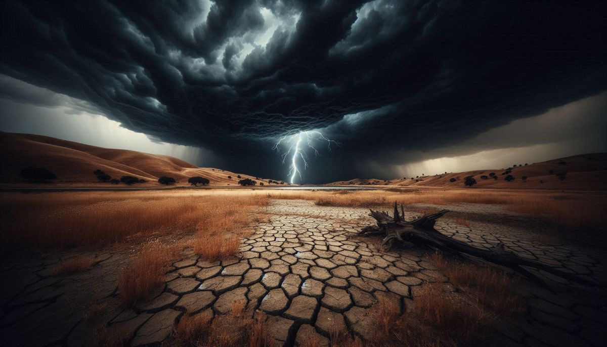
When we think of thunderstorms, images of heavy rain often come to mind – a natural quencher of flames. However, a specific and increasingly dangerous phenomenon flips this expectation: the dry thunderstorm. These storms, like the one implicated in recent devastating wildfires in Greece, unleash potent lightning strikes with little to no accompanying rainfall reaching the ground. This deadly combination creates exceptionally high-risk conditions for wildfire ignition and rapid spread, posing a significant threat to ecosystems, communities, and economies worldwide.
This article delves deep into the science behind dry thunderstorms, explores why they are such effective wildfire catalysts, identifies vulnerable regions, and outlines the critical strategies needed for detection, mitigation, and public preparedness. Understanding this unique hazard is the first step towards building resilience in a changing climate.
Watch video summary:
What Exactly Defines a "Dry" Thunderstorm? The Science Explained
A dry thunderstorm isn't entirely devoid of precipitation; the key is that the rain or hail produced evaporates before hitting the earth. This atmospheric process, known as virga, is central to the phenomenon.
Several specific atmospheric conditions must converge for a dry thunderstorm to form:
- Sufficient Instability and Moisture Aloft: Like any thunderstorm, there needs to be enough atmospheric instability (often measured by CAPE - Convective Available Potential Energy) and moisture in the mid-to-upper atmosphere to form convective clouds (cumulonimbus).
- A Deep, Dry Lower Atmosphere: Crucially, the layer of air between the cloud base and the ground must be very dry (low relative humidity). This causes the falling precipitation (rain or ice crystals) to sublimate or evaporate as it descends through this arid layer.
- High Cloud Bases: The dryness in the lower atmosphere often results in higher cloud bases (a higher Lifted Condensation Level - LCL). The longer distance precipitation must fall through dry air increases the likelihood of complete evaporation.
In contrast, a "wet" thunderstorm occurs when the atmosphere below the cloud is sufficiently moist, allowing precipitation to reach the surface, often in significant amounts that can help extinguish small fires ignited by lightning.
Understanding virga is key: you might see streaks of precipitation falling from the cloud, but the ground below remains dry, receiving only lightning and wind.
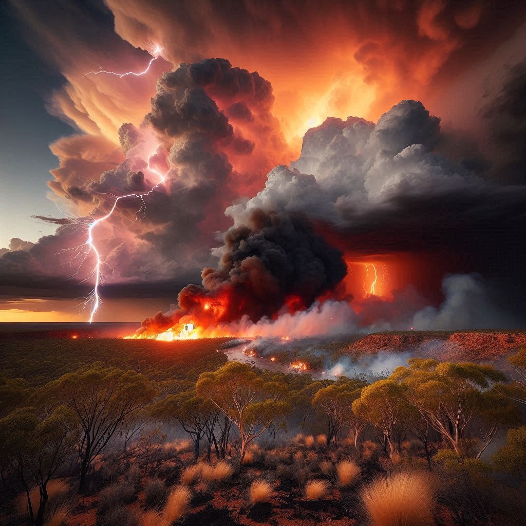
The Perfect Firestorm: Why Dry Thunderstorms are Uniquely Dangerous Wildfire Starters
The combination of factors present during a dry thunderstorm creates a perilous environment for wildfire ignition and behaviour. It's not just one element, but their synergy, that makes these storms so hazardous:
1. Abundant Cloud-to-Ground Lightning
Thunderstorms, whether wet or dry, generate lightning. However, in a dry thunderstorm context, each cloud-to-ground strike becomes a potential ignition source hitting receptive fuels. Lightning channels can reach temperatures exceeding 50,000°F (around 27,760°C), easily igniting dry vegetation like grasses, pine needles, dead wood (snags), and leaf litter. The duration of the current flow in some "hot" lightning strikes can also contribute to successful ignition.
2. Lack of Wetting Precipitation
This is the defining characteristic. While a wet storm might extinguish its own lightning-caused fires with subsequent rain, the virga from a dry thunderstorm offers no such benefit. Any minimal moisture that reaches the ground evaporates almost instantly, leaving fuels critically dry and ready to burn. Even trace amounts of precipitation are insufficient to raise fuel moisture levels significantly.
3. Gusty, Erratic Outflow Winds
Thunderstorms generate powerful downdrafts – columns of cooling air sinking rapidly. As these hit the ground, they spread outwards, creating strong, gusty, and often unpredictable surface winds (outflow). These winds, sometimes reaching speeds of 40-60 mph (65-95 km/h) or more in microbursts, can:
- Fan newly ignited flames into raging fires almost instantaneously.
- Cause rapid and erratic changes in fire direction and spread rate, making firefighting exceptionally dangerous.
- Carry embers (firebrands) long distances ahead of the main fire front (spotting), starting new fires far away and compromising containment lines.
4. Pre-existing Low Humidity and Dry Fuels
Dry thunderstorms typically occur during hot, dry weather patterns often associated with drought. This means the vegetation (fuels) is already primed for ignition due to low fuel moisture content. The low relative humidity accompanying the storm further exacerbates this, ensuring that fires catch easily and burn intensely.
This table summarizes the key differences in fire risk:
| Feature | Dry Thunderstorm | Wet Thunderstorm |
|---|---|---|
| Precipitation Reaching Ground | Little to none (Virga) | Significant rain/hail |
| Lightning Ignition Potential | High (no quenching effect) | Moderate (often quenched by rain) |
| Fuel Moisture Impact | Fuels remain critically dry | Fuels become wet, harder to ignite |
| Wind Impact | Strong, erratic outflow rapidly spreads fire | Outflow winds exist, but fire spread may be slowed by wet fuels |
| Overall Wildfire Risk | Extremely High | Lower (though ignition is still possible) |
Global Hotspots: Where Dry Thunderstorms Drive Wildfire Seasons
While possible in many areas under the right conditions, certain regions are particularly prone to dry thunderstorms and the resulting wildfires:
- Western United States: States like California, Arizona, Nevada, Oregon, Washington, Idaho, and Montana frequently experience dry thunderstorms, especially during late spring, summer, and early fall. Monsoonal patterns interacting with dry air masses are a common trigger. Agencies like the U.S. National Weather Service (NWS) issue specific Fire Weather Watches and Red Flag Warnings when conditions are prime.
- Mediterranean Basin: Countries including Greece, Italy, Spain, Portugal, and Turkey face significant risk during their hot, dry summers. The combination of dry climate, flammable vegetation (like maquis shrubland), and occasional convective activity creates high danger.
- Australia: Particularly during the spring and summer fire seasons in southern and eastern Australia, dry lightning storms are a major cause of bushfires, especially in forested and grassland areas following periods of drought.
- Other Regions: Parts of South America (e.g., central Chile, parts of Argentina), South Africa, and even occasionally continental Europe can experience conditions conducive to dry thunderstorms and associated fire risk, especially during prolonged dry spells or heatwaves.
Climate change is projected to exacerbate conditions favorable for dry thunderstorms and increase overall wildfire risk in many of these regions due to rising temperatures and potentially altered precipitation patterns. (IPCC Sixth Assessment Report)
Detecting the Invisible Threat: Early Warning Systems are Crucial
Given the rapid ignition potential, early detection of lightning strikes and resulting fires is paramount.
- Lightning Detection Networks: Ground-based sensor networks, such as the National Lightning Detection Network (NLDN) in the US, pinpoint cloud-to-ground strikes in real-time with high accuracy (often within a few hundred meters). This allows fire managers to identify high-risk areas immediately after a storm passes. Similar networks operate globally.
- Weather Forecasting and Modeling: Meteorologists use sophisticated weather models to predict atmospheric conditions conducive to dry thunderstorm development. They analyze instability, moisture profiles, and lower atmospheric dryness to issue forecasts and alerts.
- Satellite Remote Sensing: Geostationary satellites (like GOES) and polar-orbiting satellites (like VIIRS) carry instruments that can detect the heat signatures of new fires, often within minutes of ignition, and monitor smoke plumes.
- Aerial Reconnaissance: In high-risk situations, aircraft may patrol areas recently affected by dry lightning to spot new fire starts quickly.
- Public Reporting: Vigilant citizens reporting smoke or flames remain a vital part of the detection system.
Mitigation Strategies: Reducing Wildfire Risk from Dry Lightning
Preventing dry thunderstorms themselves is impossible, but communities and land managers can take proactive steps to reduce the likelihood of ignition and mitigate the impact of fires that do start.
1. Strategic Fuel Management
Reducing the amount and continuity of flammable vegetation is key.
- Prescribed Fire: Intentionally setting controlled burns under specific, carefully managed weather conditions to reduce hazardous fuel loads (dead grass, brush, dense undergrowth), restore ecosystem health, and create landscapes less prone to uncontrollable wildfires. This requires rigorous planning and execution by trained professionals. (U.S. Forest Service - Prescribed Fire)
- Mechanical Treatments: Using machinery to thin dense forests, remove underbrush (mastication), or create fuel breaks. This is often used where prescribed fire is impractical or too risky.
- Targeted Grazing: Using livestock like goats or cattle to reduce grass and brush in specific areas.
- Creating Fuel Breaks: Strategically clearing vegetation along roads, ridges, or around communities to slow fire spread and provide safe access points for firefighters. These can range from simple roadside clearing to wider "shaded fuel breaks" in forests.
2. Rapid and Aggressive Initial Attack
When a lightning fire starts in dry conditions, speed is everything. Firefighting agencies prioritize hitting these ignitions hard and fast with resources like:
- Air Tankers and Helicopters: Dropping water or retardant to slow the fire's spread and cool hotspots, allowing ground crews access.
- Smokejumpers and Helitack Crews: Highly trained firefighters who can parachute or rappel into remote areas for immediate ground attack.
- Engine Crews: Standard fire engines providing water and personnel for containment line construction.
The goal is to contain the fire while it is still small (typically under 10 acres), preventing it from escaping initial attack and becoming a major incident.
3. Public Awareness and Community Preparedness
An informed and prepared public is essential for safety.
- Understanding Fire Weather Alerts: Knowing the difference between a Fire Weather Watch (conditions possible) and a Red Flag Warning (conditions imminent or occurring) issued by meteorological services.
- Creating Defensible Space: Homeowners in fire-prone areas must maintain defensible space around their properties. This involves specific zones of vegetation management:
- Zone 1 (0-5 feet from house): Use non-flammable materials (gravel, concrete). Remove all dead vegetation. Keep gutters clean. No flammable structures (e.g., wooden fences) attached to the house.
- Zone 2 (5-30 feet): Keep grass mowed short (under 4 inches). Create separation between trees and shrubs. Remove lower tree limbs (up to 6-10 feet).
- Zone 3 (30-100 feet, or to property line): Thin vegetation, reduce density of trees, remove dead material.
- (Learn more from programs like Firewise USA®).
- Home Hardening: Using fire-resistant building materials (roofing, siding, vents, windows) to reduce the chance of ignition from embers.
- Evacuation Planning: Knowing multiple evacuation routes, having a "go-bag" prepared with essentials (medications, documents, water, food), and heeding evacuation orders promptly.
The Wider Impacts
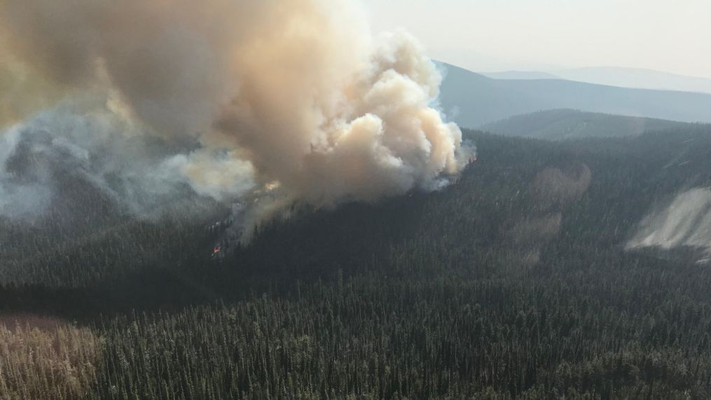
Wildfires ignited by dry thunderstorms have far-reaching consequences beyond the immediate flames. They cause significant ecological damage, destroy habitats, lead to soil erosion and water contamination, release vast amounts of carbon into the atmosphere, impact air quality over large regions (posing health risks, especially for respiratory conditions), cause billions in property damage and economic disruption, and tragically, can result in injury and loss of human life.
Conclusion: Facing the Fiery Threat
Dry thunderstorms represent a potent and dangerous intersection of weather and landscape. Their ability to spark numerous fires simultaneously across potentially vast, dry areas, combined with erratic winds, makes them one of nature's most efficient wildfire starters. As climate change potentially increases the frequency and intensity of conditions favorable for these events in vulnerable regions, understanding the science, improving detection methods, implementing robust fuel management strategies, and fostering community preparedness are not just advisable – they are imperative.
Continued investment in research, forecasting technology, land management practices, and public education is crucial to mitigate the devastating potential of wildfires ignited by the seemingly paradoxical phenomenon of a storm without rain.